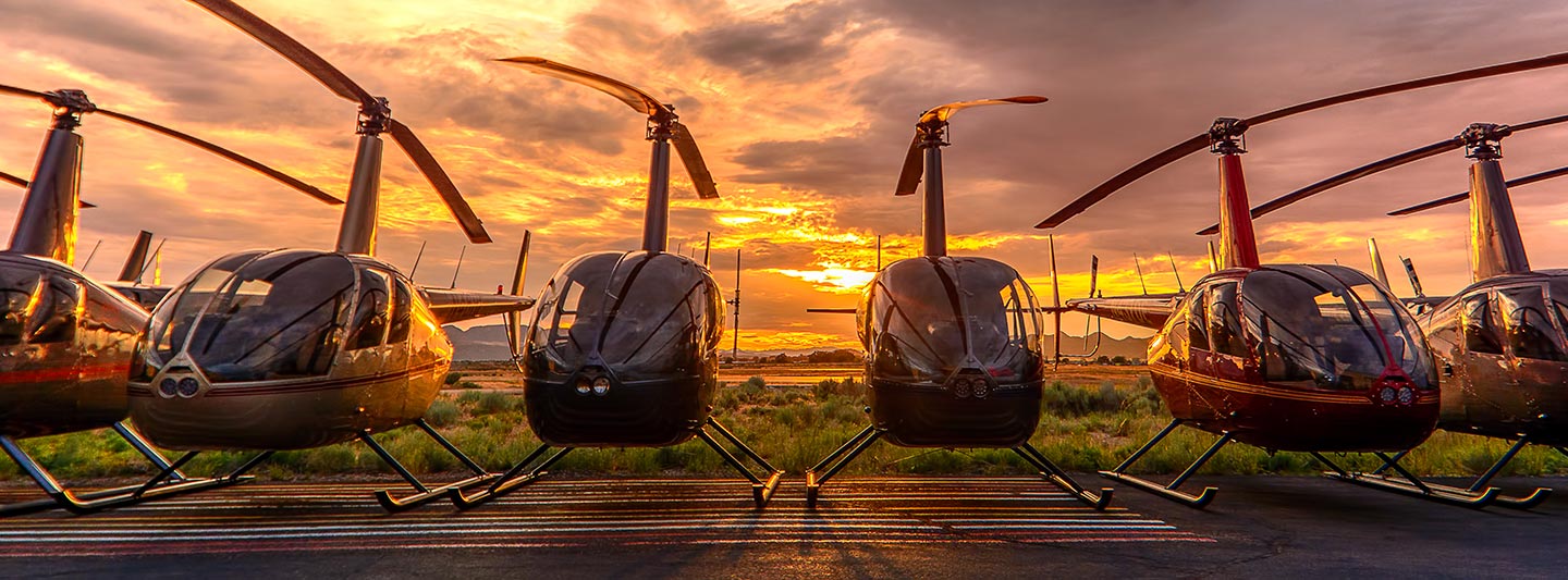
Precision Aerial Surveys and Advanced Media Capture in Costa Mesa
Unrivaled Aerial Perspective for California
Costa Mesa Helicopter Charters provides comprehensive aerial survey capabilities across California, leveraging the inherent advantages of helicopters for precise data acquisition. Our services encompass advanced solutions such as magnetometer and electromagnetic surveys, LiDAR, and Geographic Information System (GIS) mapping, utilizing the helicopter's unique low-altitude and hover proficiencies. Furthermore, we specialize in high-definition aerial filming services, offering access to state-of-the-art cinematography and photography technology, including configurable aircraft that allow for door removal to facilitate handheld or specialized camera setups. We are your definitive resource for sophisticated airborne visualization and data capture throughout California.
Aerial
Surveys
LiDAR, GIS Maps, FLIR, HD Video & More
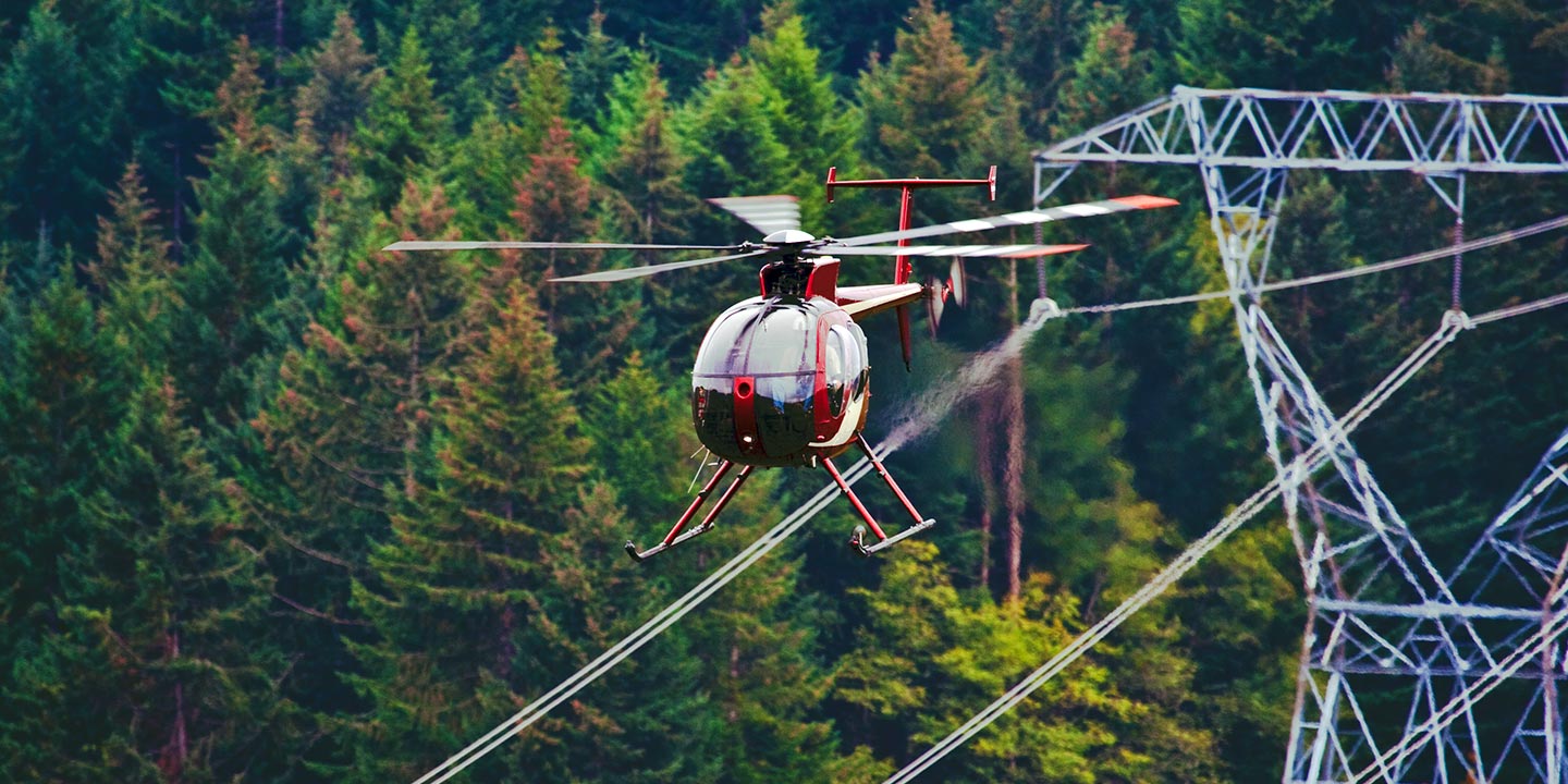
For critical infrastructure management, Costa Mesa Helicopter Charters provides unparalleled aerial inspection services. From comprehensive pipeline integrity assessments and Right-of-Way (ROW) compliance evaluations to meticulous transmission line patrols, we deploy specialized helicopters. These operations are executed with precision equipment, ensuring your project objectives are met accurately and efficiently, safeguarding your assets and operational continuity.
High Tech Results
The Top Pilots in California, Today's Technology... Maximum Results.
Call 1-866-826-4826 Now!
Costa Mesa Helicopter Charters provides the tools needed to complete your land surveys, utilizing the right equipment to provide the aerial photos that are often needed.
Effective aerial surveys are pivotal for streamlining critical operations such as Right-of-Way (ROW) and site inspections, topographical data acquisition, and high-definition imaging for commercial projects. Helicopter surveys offer the most efficient method for observing California's diverse terrain, precisely identifying pipeline anomalies, detecting issues within transmission lines, or capturing detailed video and photographic documentation of properties. Costa Mesa Helicopter Charters excels in developing tailored photographic and remote sensing operations, custom-engineered to maximize both technical efficiency and financial viability, delivering superior results for your critical infrastructure and land management needs.
Helicopters offer distinct operational advantages for aerial surveying, primarily due to their superior maneuverability at lower altitudes and reduced airspeeds compared to fixed-wing aircraft. While fixed-wing operations are typically restricted to altitudes of at least 1,000 feet above obstacles by Federal Aviation Administration (FAA) regulations, helicopters can safely operate at significantly lower levels. This unique capability allows for the precise inspection of challenging or hazardous zones, providing engineers and project managers with critical vantage points that are otherwise unattainable, enhancing detailed data capture and situational awareness.
There is no better way to conduct your visual survey, animal population counts, soil drainage analysis, ROW inspections, pipeline and transmission line inspections, and geographical surveys.
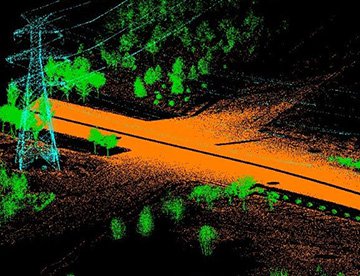
LiDAR Imaging
Light Detection and Ranging, or LiDAR, is a remote sensing method used to examine and measure California topography as well as objects, like vegetation, upon it.
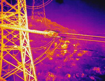
Infrared Imaging
Thermographic IR cameras are used to detect radiation in the long-infrared range of the electromagnetic spectrum and produce images of that radiation, called thermograms.
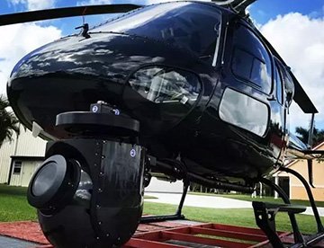
HD Video Gimbal Capture
Modern HD and 4K cameras can be mounted to helicopters, using the proper STCs, with a gimbal to stabilize photos & videos for detailed results.
Elite Aerial Filming and High-Definition Videography Solutions
For expert camera work in the Costa Mesa Sky
Get a Fast, free QuoteCosta Mesa Aerial Cinematography
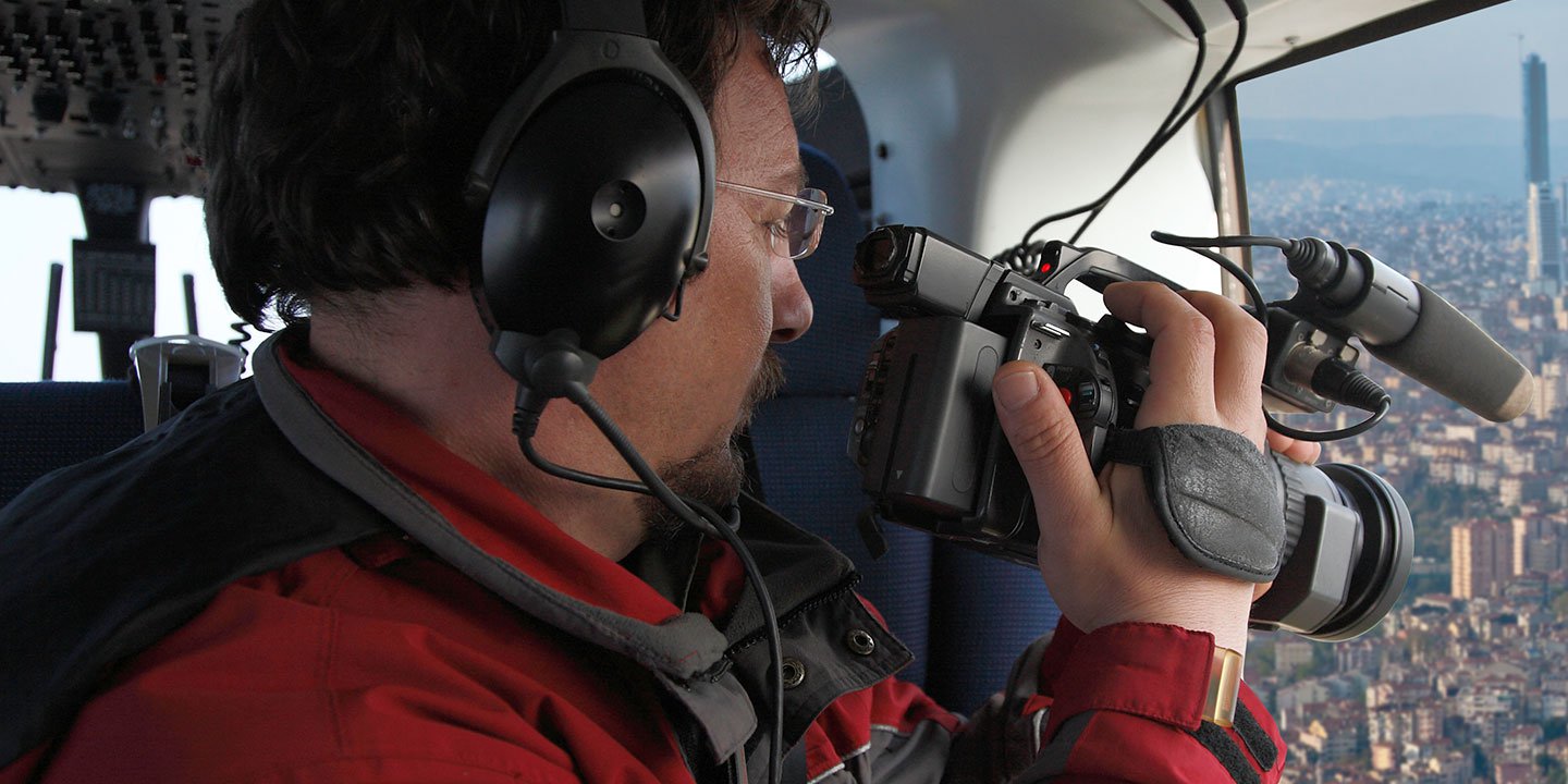
Costa Mesa Helicopter Charters provides unparalleled access to professional-grade aerial cinematography resources throughout California. Our network delivers bespoke solutions, integrating cutting-edge technology such as advanced gyro-stabilized camera mounts, including Tyler Mounts, Wesscam, Cineflex, Pictorvision, and SpaceCam platforms. These are paired with industry-leading specialty cameras like the Cineflex HD, RED Epic, Arri Alexa, and even experimental 3D camera systems. We meticulously support all facets of your production goals, whether requiring air-to-air or ground-to-air perspectives. We specialize in deploying optimal helicopter configurations for both still and motion photography, catering to diverse media projects across California, from feature films, television series, and documentaries to promotional videos, commercials, and live event coverage. Our expertise ensures seamless execution and visual excellence for any media-related operation.
Call Us Today at 1-866-826-4826 for a Free Quote
Contact Us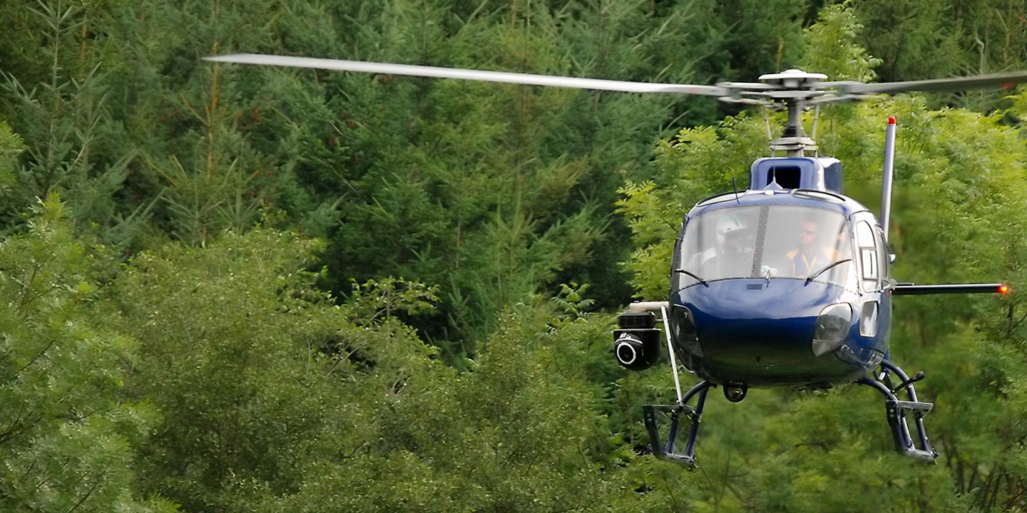
Aerial Photos
Hand-held or Mounted OpTions in Costa Mesa
We will help you get the right equipment for your aerial photography project! Call 1-866-826-4826 today to get a fast, free quote.
The Most Options for Photography
Leverage the strategic advantage of capturing California's iconic landscapes and critical infrastructure from an unparalleled aerial perspective. Our customized aerial photography charters are engineered to translate your precise vision into stunning visual assets, providing solutions ranging from door-removed configurations for dynamic handheld work to advanced gyro-stabilized mounts for superior image stability. We offer cost-effective access to these capabilities, enabling project managers, marketers, and creative directors in Costa Mesa and across California to achieve exceptional results. Contact us to discuss how we can elevate your visual documentation needs with precision and clarity.
Superior Service
Every one of our customers gets a dedicated helicopter expert to assist with flight plans, tech loadouts, production logistics, project schedules, and other demands.
Over 500 Aircraft
Our network of direct air partners extends well beyond Costa Mesa, California. This allows us to offer a wide range of solutions for even the most sophisticated projects.
The Best Equipment
From high-tech sensors like LiDAR, FLIR, and GIS to HD cameras and movie production gimbals, we're here to make your job as easy as possible.